What Plants Can Tell Us in Alberta’s Boreal Forest Before We Dig
Content provided by: Alexandra Burchill
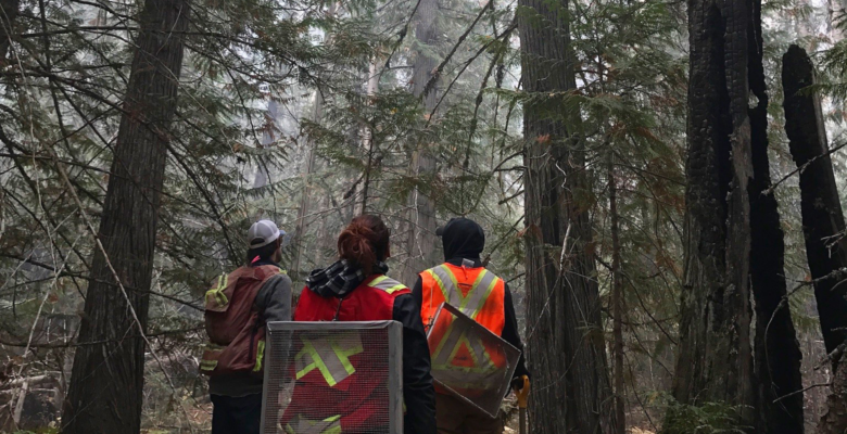
When our team enters an area of interest, one of the first things we do is assess the rugged terrain and no; this isn’t a Ford F150 commercial. Both historically and statistically, archaeology sites are typically found somewhere high and dry on well-defined landforms. Imagine going camping in the woods, and you’re trying to find somewhere decent to pitch your tent (yes, we’re still talking about camping). You’d likely look for somewhere flat that’s not too wet but where you still have access to some water source.
Since we can’t systematically shovel test project areas (our clients nor we are made of money), our teams will select high potential areas instead of testing the whole thing. Sometimes, we have to walk away from areas that we thought had high potential because they didn’t meet the needs. We figure out what areas best meet our standards based on a repetitive series of questions. Think of how you always have your go-to questions on a first date. You’ll ask questions like what do you do, how many siblings do you have, have you ever murdered anyone… you know, the basics! The area-specific questions we like to ask ourselves often include how defined is the landform? How does it compare to nearby landforms? Where is the nearest water source? Lastly, what is the vegetation like? Sometimes the most important thing we can do when assessing the soil is seeing what kinds of plants and trees are popping out of it.
Vegetation is commonly used to get a sense of drainage in a particular area. Some plants serve as a beneficial indicator species of saturated soils or dry, well-drained soils. Remember, we are always on the lookout for those high and dry areas on some well-defined landforms. While we can’t rely on vegetation alone to assess these conditions, usually, they provide some good indicators. These are some of our favourite plants to look out for.
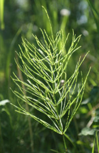
First up is Horsetail. Much like a big wedding during COVID, it’s considered a ‘super spreader’ because it grows so well all across North America. Horsetail is a standard indicator of poorly drained soils and is considered by some to be a weed. It often grows in low-lying terrain in or close to wetlands. Usually, horsetail indicates lower site potential.
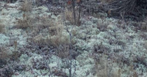
This type of moss goes by many names, including Reindeer Moss, Deer Moss, or Caribou Moss. It’s dealer’s choice for whatever you want to call it. Personally, we are team Reindeer Moss here at Circle because when we see it, there are some definite Christmas morning vibes in the air. This type of moss is a great indicator of well-drained dry soils. It’s found in elevated, open areas with characteristically shallow sandy soils. Basically, it means higher site potential.
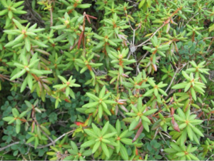
Another plant species indicating poorly drained soils is Labrador Tea. Don’t put your guard too far down around this little plant. Although delicious when brewed and consumed in small quantities, please exercise restraint because it is poisonous if consumed in larger amounts. Labrador Tea is a high indicator of low-marshy, swampy terrain and lower site potential.
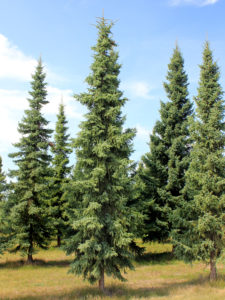
Black Spruce is yet another indicator of poorly drained soils. So if you see black spruce, its besties like Horsetail and Labrador Tea are likely in tow.
Hopefully, you’ve learned a little more about the plant life here in Alberta so that if you are into backcountry camping, you’ll have some knowledge in picking out a decent campsite. Happy trails!
SHARE THIS:


